How can Ambee’s active fire data help reduce and prevent forest fires

Introduction
Uncontrolled active fires can pose serious risks. The immediate and long-lasting repercussions of a fire’s rapid spread include harm to people, land, wildlife, and the environment. Fire causes respiratory illnesses, lowers air quality levels, and impacts the environment by releasing carbon dioxide & particulate matter into the atmosphere.
According to the United States Department of Interior, people are responsible for most wildfires. The causes of the spread of fire include uncontrolled campfires, spontaneous burning of debris, carelessly tossed cigarettes, and deliberate acts of arson. Experts on climate change claim that global warming has also caused a recurrent pattern of wildfire seasons.
Smoke contains a variety of hazardous substances, but PM2.5 is by far the most dangerous. These particles can enter the lungs and occasionally make their way into the circulation, leading to issues with the heart, the lungs, and the nervous system. Asthma, eczema, stroke, cancer, and other conditions are all made worse by PM2.5 exposure.
Fire emissions are dangerous for everyone, but perhaps the most vulnerable groups are children, stroke survivors, pregnant women, people over 65, individuals with respiratory conditions, and people with diabetes, according to a paper by the Lancet. Smoking has further side effects of wheezing, shortness of breath, coughing, and headaches. Additionally, it raises health risks for COVID-19 patients, even those who have healed.
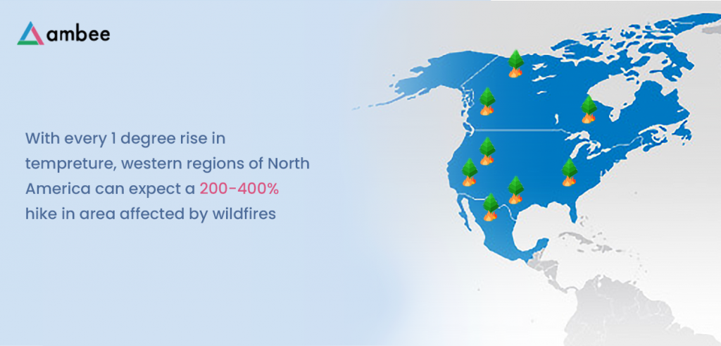
Fire’s destructive effects on the environment are just as severe as those on people. Wildfires have been seen in many countries during the previous three years, including Australia, the USA, British Columbia in Canada, and the Amazon rainforest. Communities in Western America experienced one of the deadliest wildfire episodes in 2020, in addition to the global epidemic.


What Is Happening Around the World Right Now?
The USDA Forest Service’s most recent reports indicate that the fire season now lasts 6 – 8 weeks rather than the four months it was originally estimated to last each year. Wildfires are often coming sooner, burning more ferociously, and spreading to bigger land areas. The United States is currently experiencing a severe wildfire season across the nation in 2021, following a similar trend to what was seen in 2020.
In reaction to raging flames, Mediterranean nations like Turkey, Greece, and Italy have also had to order the evacuation of citizens and visitors from large portions of their countries. Even sparsely populated areas like Siberia experienced uncontrollable wildfires this year, which have already shattered annual records regarding fire-related emissions, as per the European Copernicus Atmospheric Monitoring Service (CAMS).

However, harm has been caused by more than simply the frequent wildfires in different parts of the world. In some areas of India, caused primarily by the burning of stubble, man-made fires have badly harmed the air quality and sparked worries about their impact on the climate. Farmers in the northwest Indian states of Punjab and Haryana primarily burn stubble, in which they burn their paddy fields to prepare the ground for the upcoming sowing season. This action causes several issues, particularly in border states and cities with severe air pollution. This has been emphasized numerous times, particularly when The Great Smog of Delhi 2017 began.

The Times of India reported that between September 1 and November 16, 2021, 74,015 fires occurred in Punjab. This broke the previous record for the greatest count in the previous five years; in 2016, a total of 84,886 fires were recorded. The burning of stubble and fireworks lighting during Diwali are contributing factors to the low AQI.
As of November 23, according to data about global air pollution, Punjab’s AQI was set at 164, while the corresponding figures for Delhi and Haryana were unfavorable at 159 and 155, respectively. Compared to the permitted level of air pollution, around 50, these statistics are more than three times higher.

High quantities of particulate matter, primarily PM 2.5, are also detected in the atmosphere. The safe range for PM2.5 is 0 to 12 g/m3, while statistics from Punjab, Delhi, & Haryana indicate that PM2.5 is present at 81.5, 60.4, and 63 g/m3, respectively.

The uncontrolled fire was a serious concern for a while, harming the environment and the public’s health in numerous ways. It has hazards, and serious steps must be done to reduce them.

Ambee’s real-time active forest fire data helps reduce damage and save lives

The increase in extremely active fires brought on by changing global temperatures puts ecosystems, people, and property in peril. Modern technology from Ambee ensures crucial information gets you on time & lessens mishaps.

Ambee has created an environmental index and intelligence for the entire planet, down to the level of individual communities, updated every few minutes using patented data science methodologies. Anyone around the globe can now understand the environment in a small, localized area in real-time. Ambee’s data is already utilized to drive choices across continents, from startup and Fortune 100 companies to governments, ranging from turning on air purifiers to ensuring long-term medical – insurance risks.

Real-time fire data is accessible using Ambee’s Fire API. Protect your users from nearby wildfires and other active fires. You may prevent active fire disasters, losses, and casualties by providing your clients with our exclusive real-time fire data. Today, take precautions against both natural and artificial fires.


What Can We Do About It?
In September 2021, the World Health Organization (WHO) released an updated set of recommendations that aim to protect human health and the environment by reducing important air pollutants such as ozone (O3), particulate matter (PM), nitrogen dioxide (NO2), sulfur dioxide (SO2), and carbon monoxide (CO).

At COP26, WHO also sponsored a side event wherein they voiced their worries about the declining climate or air quality state and called for changes to the laws and tools required to address health-related problems, such as lowering air pollution.
Governmental and non-governmental groups worldwide have released regulations and guidelines for controlling and minimizing man-made fires to combat this problem. These policies always aid in keeping an eye on the situation, but we as people may also assist. There are various ways we can make a difference in the world. One method is to use data from fire and air quality monitoring to detect ongoing flames and even identify risky places.

Ambee’s hyperlocal air quality & fire data can be used by organizations to inform the public about places prone to fires. Ambee’s fire API enables users to find areas prone to fires and identify active fires internationally to prevent damage and injuries. Organizations may monitor places to avoid high-risk areas and alert their consumers to prepare for major disasters with the help of reliable and hyperlocal data.
Air quality monitoring data can be used with fire data to track harmful levels of pollution load in any area on the planet. Creating policies to regulate air quality, disseminating information to the public, and developing long-term strategies to lower emissions and dangers can all benefit from the generation of actionable insights. The data on air quality levels could also be used to control demand and supply for medications and assess and warn people about the negative impacts of air pollution by fires.

Everything we do impacts us as we enter an uncertain world on the verge of a climate disaster. A single action could create a cascade of effects that could worsen the situation. Imagine a world where we must carefully consider if our actions would harm the environment. Ambee’s fire & air quality APIs were created with this in mind, accumulating data to reduce the hazards brought on by fire or air pollution data.

5 Ways You Can Utilize Fire Data To Create A Safer Environment

Introduction

We have a lot of fire data on outside spaces due to advancements and the broad usage of GPS technology. We know what the fastest paths to a specific location are in real-time. Response teams use technology to get to the scene of a disaster in record speed – firefighters, for example, have an ideal response of just 5 -12 minutes, which they strive to meet in 90% of emergency cases.

But what happens if they must remove survivors inside? They’ll be going in blind unless they’re already familiar with the structure – which is exceedingly unlikely considering the hundreds of structures in any one metropolis. Knowing the location of emergency exits is crucial for rescue personnel, but it is also important for everyone within the structure.

Situational awareness is one of the most crucial aspects of emergency preparedness. Even if it seems insignificant, knowing which the exits are can mean life or death and death. Rescue efforts become substantially more difficult when you don’t know where you’re heading or where you are.

Unfortunately, many businesses overlook emergency management since it is costly, difficult, or not a priority. However, emergency preparedness does not have to be difficult. Planning for possible crises gets easier, the emergency response becomes faster, and more people are likely to survive using indoor mapping for grocery shops and other interior locations. One of the most crucial instruments for fire data and forest fire data is information provided through indoor mapping. Fires, earthquakes, storms, and other natural disasters will occur — it’s a reality of life. While we may not be able to avoid tragedies, we can do the closest best thing. The first step in protecting public safety is preparing and implementing emergency plans. Today, we’ll look at how indoor mapping might assist in an actual emergency.

Evaluate Emergency Preparedness

You need to understand what you’re dealing with before you can start planning for emergencies. You can construct safer and more successful plans if you know where essential “safety points” are located, such as entrances, fire data, first aid kits, or designated assembly locations (or “muster stations”).

The term “indoor map” refers to more than floor plans. They are a visual representation of the full organization, including its equipment, resources, and personnel. An interior map can give you a lot of information about your building’s emergency preparation.

You’ll be able to spot possible bottlenecks that could hinder rescue efforts if you know how the area is being used. You’ll also be able to observe if there are any portions without any safety devices nearby.

These flaws aren’t immediately seen in day-to-day life, yet they significantly impact your safety. Indoor maps enable you to respond to problems before they cause injury.

Accurate Emergency Route Planning

The evacuation path that your employees or site visitors use can affect whether they safely make this to the assembling space. Indoor mapping can be used to map escape routes in the same manner as planning the most effective grocery and other retail areas pathways.

Indoor maps may help you determine the fastest and safest path out of a building because they show you where exits, obstructions, and other hazards are. They could also be used to design alternate routes to prevent bottlenecks and stampedes, both of which can be disastrous.

Indoor maps are, of course, only one component of a successful evacuation. Employees must understand your emergency strategy, which may be accomplished through regular evacuation exercises and crisis courses. You may also consider posting your venue maps to direct guests to the nearest exit throughout the facility.

Reduce Reaction Times

For emergency services to conduct their jobs effectively, they must access as much information as possible. The more information they have, the less time it will take them to get in and out of the facility, and the fewer mistakes they will make.

Response teams can use indoor mapping to get the information they have to move rapidly and easily around the structure. They’ll be able to see most of the entryways, emergency supplies, and pathways, which will allow them to organize their movements before acting.

Furthermore, if your employees have indoor location services activated on mobile devices, responders will be able to locate them more quickly during an evacuation. They don’t have to waste energy or time looking around the entire area because they already know where they need to go.

Real-time fire data for a safer environment

Ambee’s hyperlocal air quality and fire data inform citizens about fire-prone areas, real-rime forest fires, and the time and locations of those active fires. Ambee’s fire API enables people to detect active fire globally and locate fire-prone regions to avoid loss and injuries. With accurate and hyperlocal data, organizations can monitor locations to avoid high-risk zones and inform their customers to prepare for extreme disasters. Read more about active fire data at www.getambee.com

How Organisations Can Use Air Quality and Fire Data to Tackle Fire-Related Issues

Idea in Brief: 

  1. Unmanaged active fires are highly hazardous and cause instant damages to people, property, wildlife, and the environment. As the situation worsens across the globe, it’s clearly evident that we must take preventive steps to manage active fires better.
  2. Countries like the USA, Canada, and Australia, among others, have been facing a series of wildfires that have severely impacted public health and the environment, leaving long-term effects. Many cities in India are also witnessing a serious rise in air pollution due to reasons like stubble burning.
  3. To manage these risks, organizations can use fire and air quality monitoring data to help track active fires, predict vulnerable locations, and inform citizens about the hazardous nature of fires

Fire is considered to be humanity’s earliest and arguably the most important discovery. This discovery has led us through centuries of progress and innovations. But what happens when the fire isn’t managed carefully? It leads to a series of disastrous events that pose a threat to health and humanity.

Unmanaged active fires can be highly hazardous. The rapid spread of fire causes damages to people, property, wildlife, and the environment instantly, while having long-term effects on them. Fire releases carbon dioxide and particulate matter in the atmosphere that causes respiratory diseases, reduce air quality levels and impact the climate.

The majority of wildfires are caused by people, according to the U.S. Department of the Interior. Unattended campfires, the burning of debris, negligently discarded cigarettes, and intentional acts of arson are some of the sources that have led to the spread of fire. According to climate experts, human-induced climate change has also led to a recurring pattern of wildfire seasons worldwide. 

Smoke comprises many toxic components, and the most harmful is the minute particulate matter called PM2.5. These particles can travel into the lungs and sometimes end up in the bloodstream, causing cardiovascular, respiratory, and sometimes, neurological problems. PM2.5 exposure also worsens asthma, stroke, eczema, cancer, and more.

According to a report by the Lancet, fire emissions are unhealthy for everyone, but the most vulnerable demographics include children, pregnant women, stroke survivors, and people over 65 years of age or those who have a respiratory disease or diabetes. Smoke can also cause wheezing, coughing, shortness of breath, and headaches. It also increases health risks for people with COVID-19, including those who have recovered.

Effects of fire don’t end with humans; it also has a severe negative impact on the environment. During the past three years, wildfires have been observed across the globe, including Australia, British Columbia in Canada, the USA, and the Amazon rainforest. In 2020, communities across Western America faced one of the deadliest wildfire seasons along with the global pandemic. 

According to Insurance Information Institute’s report, since the beginning of 2019, 3 million acres of land have been burned in California due to active wildfires resulting in thousands of destroyed homes and businesses. Smoke travelling from fires in California and Oregon has severely degraded the air quality across the USA. The wildfires in Australia have also affected every state and destroyed more than 2000 homes, and burned millions of acres. 

A study conducted in 2017 also claimed that particulates like soot from wildfires in Canada had been linked to the deposition of black carbon on Greenland’s ice sheet. This accumulation of soot causes a faster melting of glaciers which warms the Arctic atmosphere and leads to a rise in sea level through the injection of freshwater into the ocean.

What Is Happening Around the World Right Now?

USDA Forest Service had previously characterized the fire season as a four-month-long event every year, but their latest reports suggest that it now stretches into six to eight months. Wildfires are starting earlier, with a higher burn intensely, and are covering larger pieces of land than ever before. In 2021, the U.S. has been facing an intense wildfire season across the country in a similar pattern to what was witnessed in 2020.  

Mediterranean countries such as Greece, Turkey, and Italy, have also been forced to evacuate residents and tourists from many parts of their country in response to blazing wildfires. According to the European Copernicus Atmosphere Monitoring Service (CAMS), even sparsely populated regions like Siberia faced uncontrollable control wildfires this year that have already broken annual records for fire-related emissions.

However, it’s not just the recurring wildfires around the world that have been of harm. Man-made fires in parts of India, mainly due to stubble burning, have seriously impacted the air quality and have raised concerns about their effect on climate.

Stubble burning is a practice followed by farmers residing in the northwestern states of India, mainly Punjab and Haryana, where they set their paddy fields on fire to prepare land for the next sowing season. This act raises several problems, including widespread air pollution, especially in their neighboring states and cities. This has been highlighted several times in the past, especially after the onset of The Great Smog of Delhi, 2017. 

According to a report published by the Times of India, Punjab witnessed 74,015 fires between September 1 and November 16, 2021. This broke the record for the highest count in the last five years, where a total of 84,886 fires were counted in 2016. Along with stubble burning, the low AQI is also due to the bursting of crackers during Diwali. 

Tracking the present data on Global Air Pollution, Punjab’s AQI is set at 164 as of November 23, whereas the Delhi and Haryana indexes show an unhealthy number of 159 and 155, respectively. These numbers are more than triple compared to the acceptable level of air pollution, which is below 50. 

The presence of high levels of particulate matter, mainly PM 2.5, in the atmosphere is also recorded. The safe level of PM2.5 ranges from 0 µg/m3 to 12 µg/m3, but Punjab, Delhi, and Haryana data suggests the presence of PM2.5 at 81.5 µg/m3, 60.4 µg/m3, and 63 µg/m3, respectively.

Unmanaged fire has been a severe crisis for a while now, causing several problems to public health and the environment. Serious measures must be taken to mitigate the risks posed by it.

What Can We Do About It?

World Health Organization (WHO) in September 2021, launched a newly updated set of guidelines that aims to protect the health of the people and the climate through reduction of key air pollutants that include – particulate matter (PM), ozone (O₃), nitrogen dioxide (NO₂), sulfur dioxide (SO₂), and carbon monoxide (CO). 

WHO, at COP26, also hosted a side event where they raised concerns over the depleting nature of climate and air quality and demanded a change in the policies and the necessary tools to tackle health-related issues, including reducing air pollution.

To fight this issue, government bodies and non-governmental organizations around the world have issued policies and guidelines for managing and reducing man-made fires. Policies such as these always help monitor the issue, but we as citizens can help as well. There are many ways in which we can contribute to the world. One way is to use fire and air quality monitoring data to help track active fires and even predict vulnerable locations.

Organizations can leverage Ambee’s hyperlocal air quality and fire data to inform citizens about fire-prone areas. Ambee’s fire API enables people to detect active fire globally and locate fire-prone regions to avoid loss and injuries. With accurate and hyperlocal data, organizations can monitor locations to avoid high-risk zones and inform their customers to prepare for extreme disasters.

In collaboration with the fire data, air quality monitoring data can also be beneficial to track the unsafe levels of pollutant concentration in any location around the globe. This can help generate actionable insights that can be used to create policies to manage air quality, inform citizens, and formulate long-term plans to reduce emissions and risks. The air quality level data can also be used to alert people against the ill effects of fire-generated air pollution, assess, and manage the demand and supply of medication.

As we head towards an uncertain world at the brink of a climate emergency, everything we do has a repercussion. Even a small action could have a series of consequences that could worsen the situation. Imagine living in a world so vulnerable that we need to think twice about whether the action we take will affect the environment negatively. With this thought in mind, Ambee’s fire and air quality APIs have been designed to accumulate data to mitigate the risks caused by fire and air pollution.